Crowd sourcing geographic data
Dr. Rodolphe Devillers and his team are like kids with new toys at Christmas.
The associate professor of geography and Dr. Arnaud Vandecasteele, post-doctoral fellow on his team, recently received 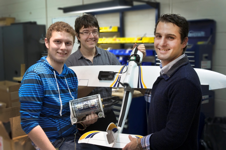 funding from the Natural Sciences and Engineering Research Council of Canada (NSERC) for two new pieces of equipment.
The new unmanned aerial vehicle (UAV) and open source remotely operated underwater vehicle (ROV) will allow Dr. Devillers and his team to test affordable technologies for crowd sourcing aerial photos and underwater images.
According to Dr. Devillers, the collection of geographic data by the general public has increased exponentially in past decades, but has been largely restricted to traditional mapping, such as the increasingly popular OpenStreetMap project. OpenStreetMap is a collaborative mapping environment onto which anyone can contribute by adding or modifying geographic data.
“Our research group studies how geographic data can be crowd sourced and is now starting to explore how new types of geographic data, such as aerial photos, can be collected by the crowd using inexpensive UAVs or ROVs and shared to the general public,” he said. “Our vision is that such inexpensive systems will become increasingly available to the general public and will constitute a source of very interesting data for society.”
Although satellites and airplanes have been historically used for collecting aerial photos, the recent development of drone technology opens up the potential for citizens and communities to use UAVs in a number of contexts, including mapping their communities and monitoring their environment.
Memorial’s Faculty of Engineering and Applied Science has extensive experience with underwater vehicles. Mechanical engineering undergraduate student Nathan Ash is assisting Dr. Devillers in assembling the open source remotely operated vehicles as part of his workterm.
“This initiative has turned into an exciting collaboration between our group in geography and a group from engineering interested in underwater vehicles,” Dr. Devillers said.
The current plan is to launch the UAV for the first time in the spring of 2014. After subsequent testing, both the UAV and the ROV will be shared with researchers across campus and in collaboration with communities and small organizations in the province of Newfoundland and Labrador.
“We anticipate such technology to play a key role in supporting research and environmental sciences,” said Dr. Devillers. “For instance, a number of graduate research projects from our geography department are focused on Canadian Arctic communities’ vulnerability to impacts of climate change. Such research projects often require up-to-date topographic maps, accurate digital elevation models and recent aerial photos, data that are often not available for most rural and remote places in Canada. A UAV could be used in this context to both collect data for student projects and at the same time test the potential benefit of using such equipment for the community more generally.”